
Site Plan Rendering Samples / Examples: A site plan is a detailed architectural or engineering drawing that shows the layout of a site, including buildings, roads, landscaping, and other important features. Site plans are commonly used in construction and development projects.
The site plan is a simplified representation of a residential property. It uses basic symbols to represent different elements, such as the house (H), garage (G), swimming pool (S), trees (T), road (R), driveway (D), patio (P), lawn (L), and fence (F). The legend at the top explains the meaning of each symbol.
Keep in mind that actual site plans for construction and development projects are typically much more detailed and include precise measurements, dimensions, and technical specifications. They are usually created using computer-aided design (CAD) software by architects, engineers, or design professionals to ensure accuracy and compliance with local regulations.
2D Site Plan / 2D Site Map Samples / Examples
Creating a 2D site plan involves illustrating the layout of a property, including buildings, landscaping, and other relevant elements, in a two-dimensional format.
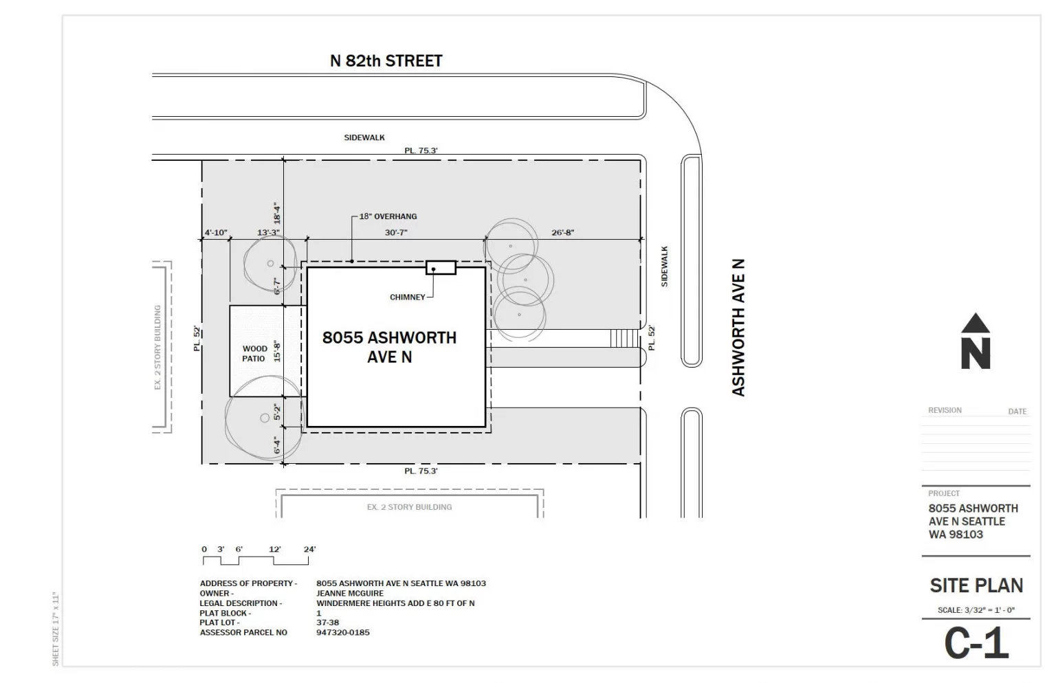
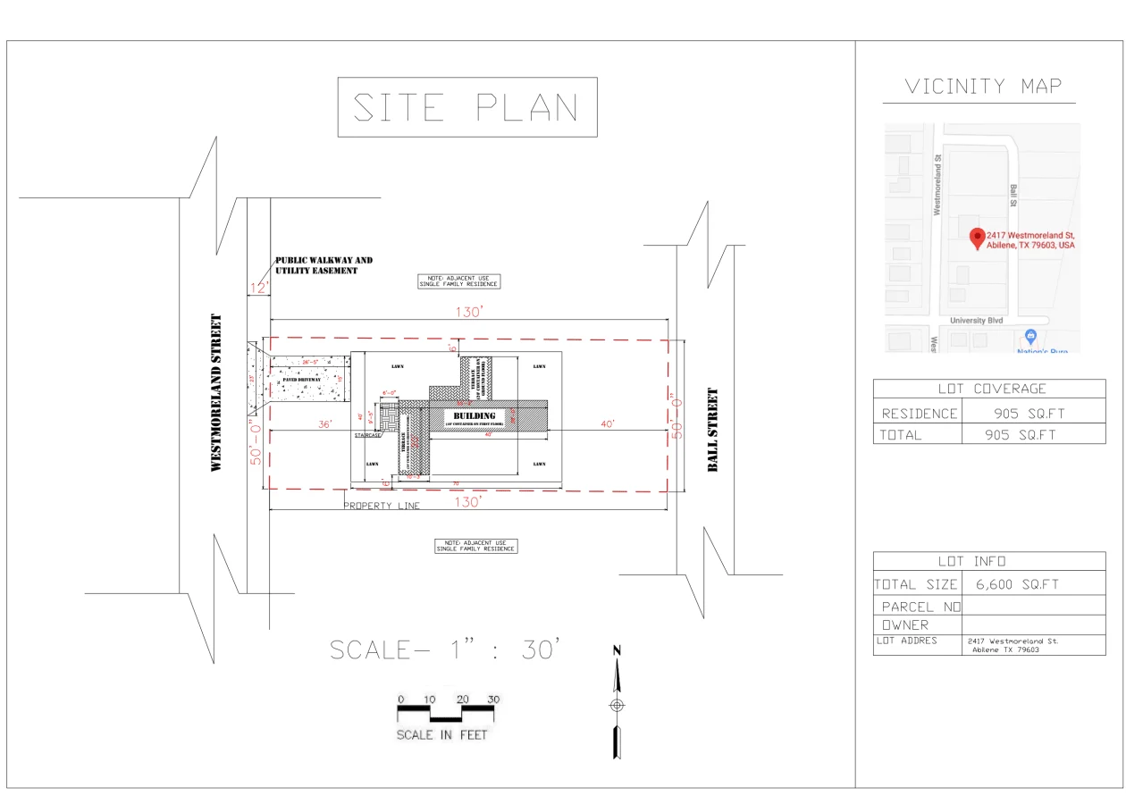
2D Black and White Site Plan / 2D Black and White Site Map Samples / Examples
Creating a 2D black and white site plan typically involves using design software or CAD (Computer-Aided Design) tools to produce detailed, monochromatic representations of a property.
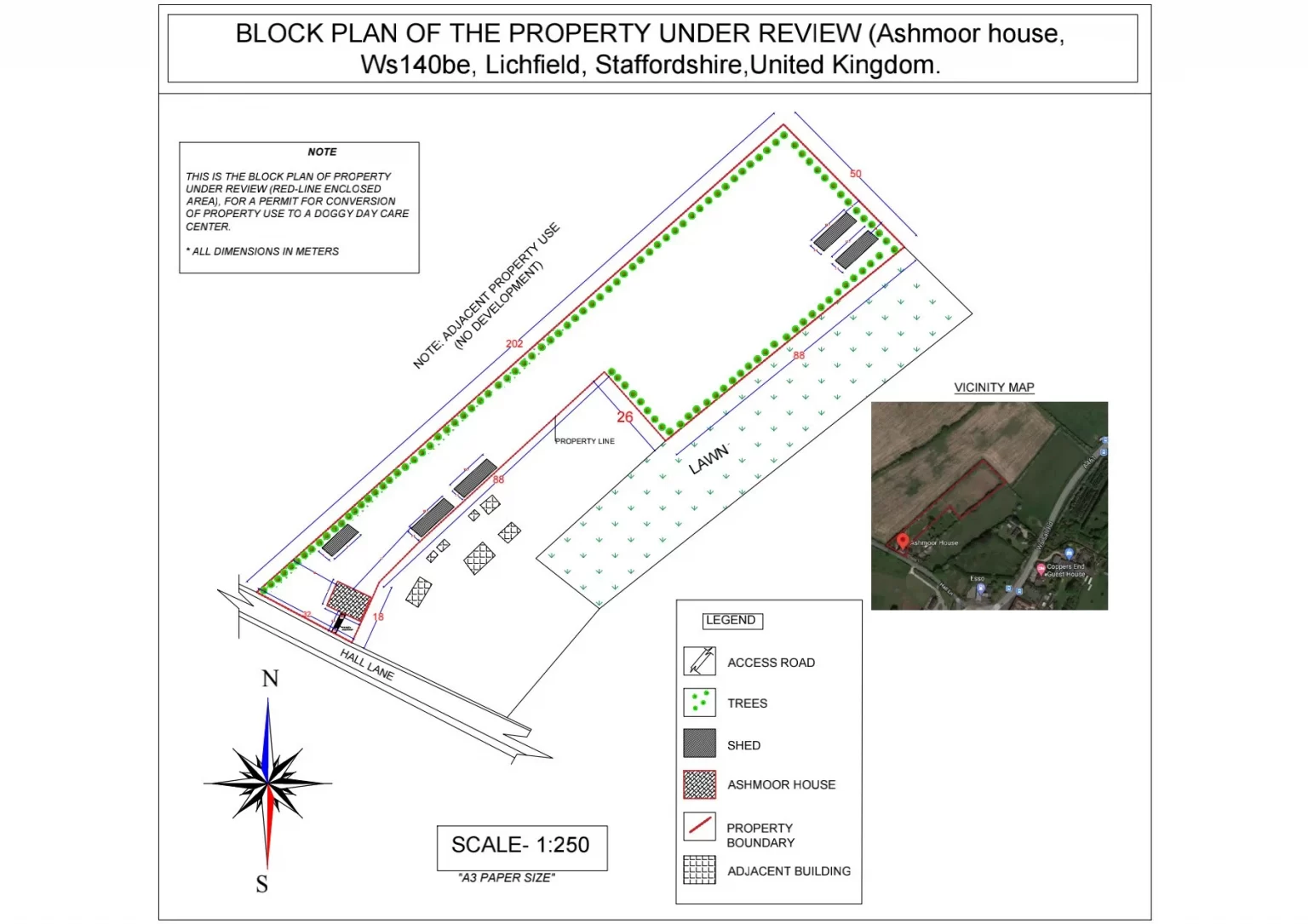
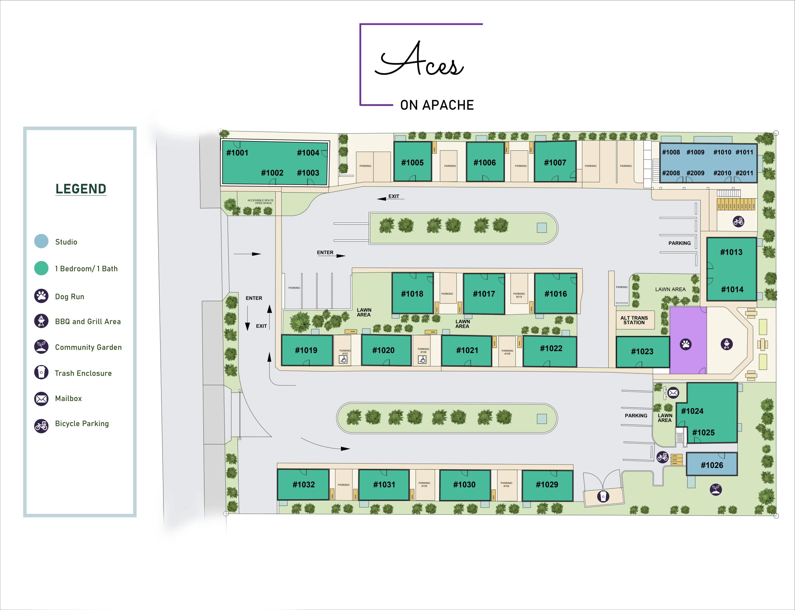
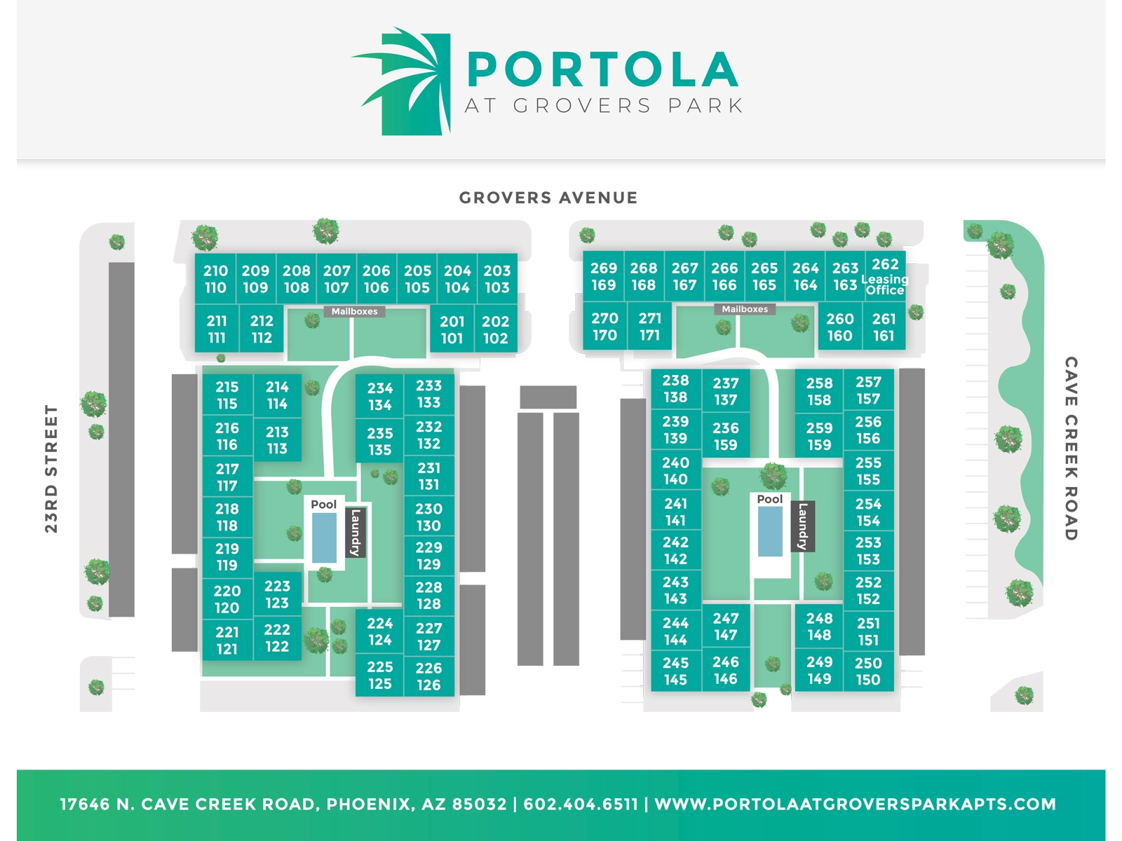
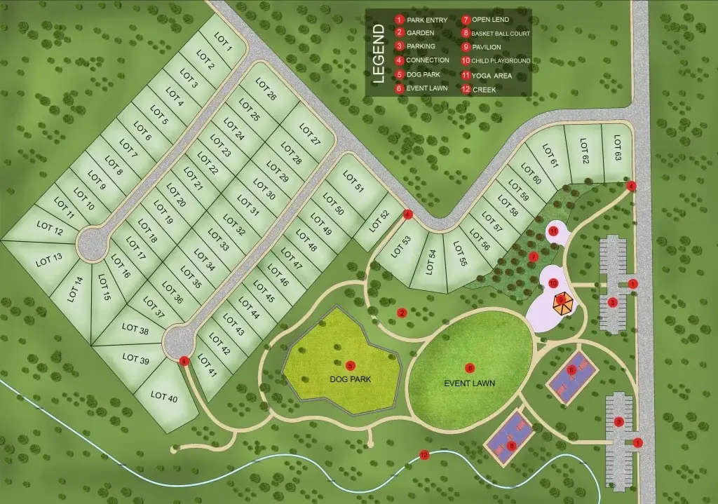
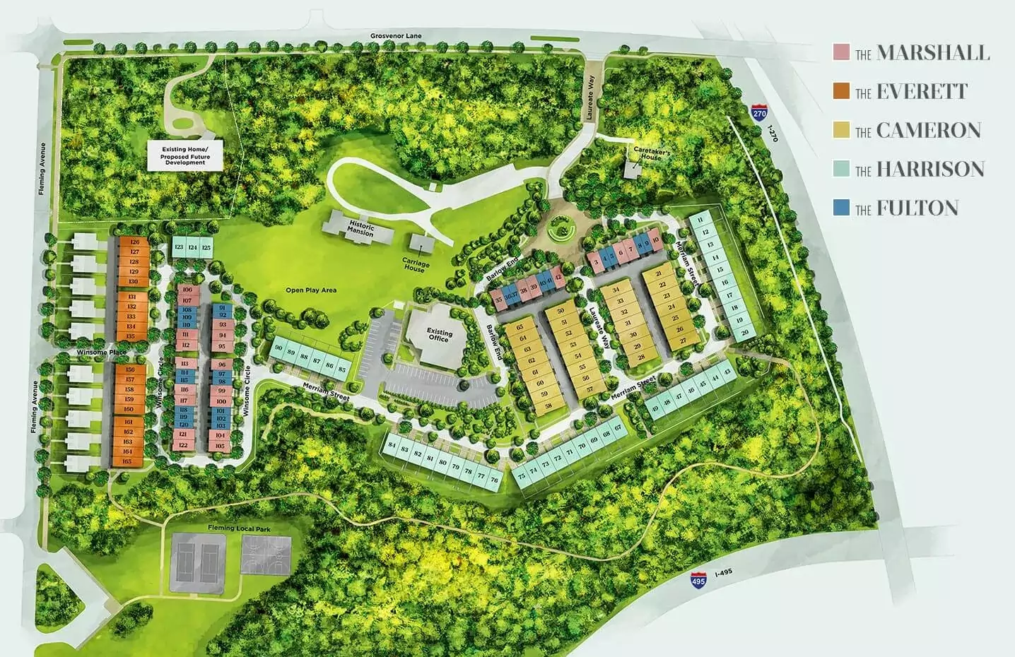
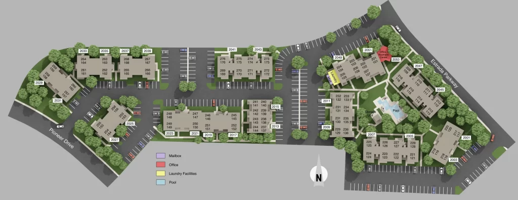
2D Colored Site Plan / 2D Colored Site Map Samples / Examples
Creating a 2D colored site plan involves using design software or CAD (Computer-Aided Design) tools to produce a detailed and visually appealing representation of a property with different colors used to differentiate various elements.
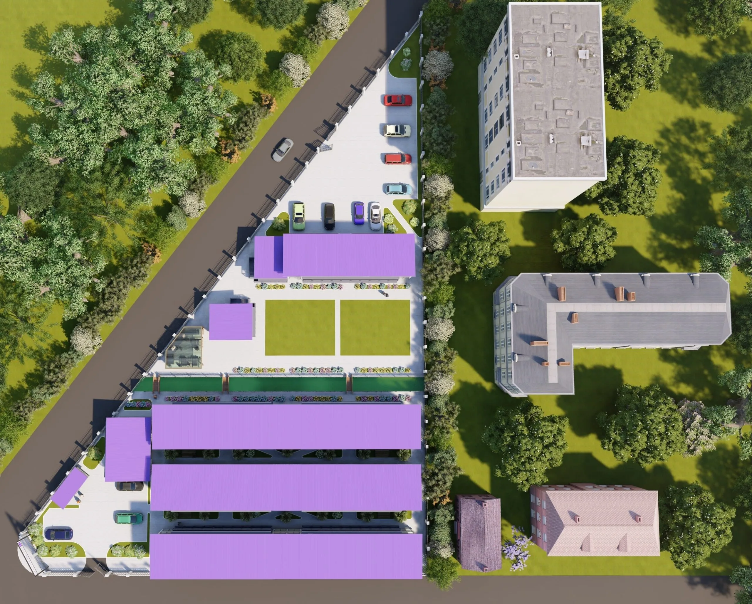
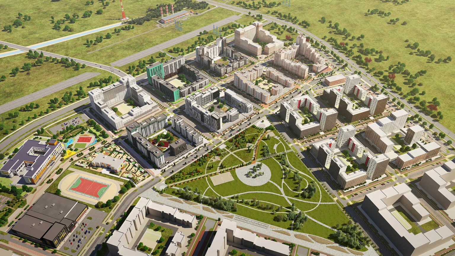
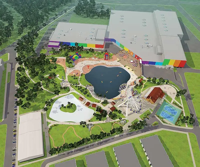
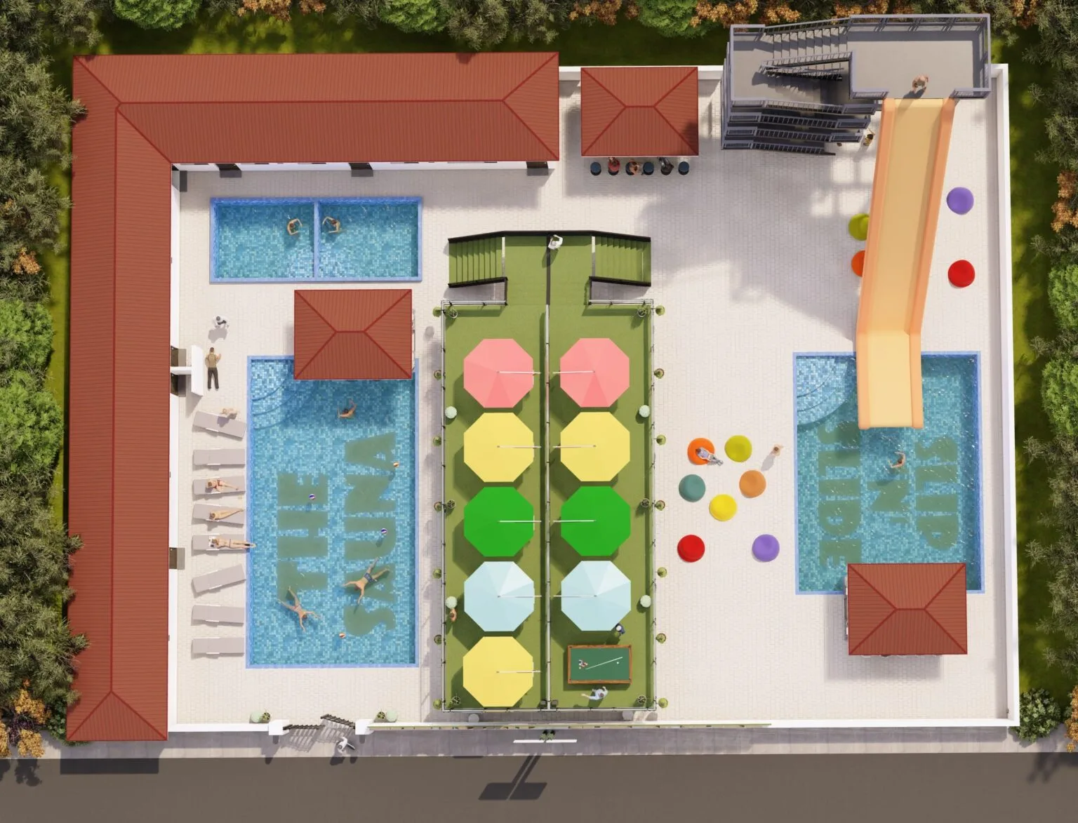
3D Site Plan / 3D Site Map Rendering Samples / Examples
Creating a 3D site plan rendering involves using 3D modeling and design software to create a three-dimensional representation of a property or site. This type of plan provides a realistic view of the property’s layout and design. A 3D site plan typically includes and looks like:
- Terrain and Topography: A 3D site plan rendering often starts with the terrain and topography of the site. It includes elevation changes, slopes, and any natural features like hills, valleys, or bodies of water.
- Buildings: 3D models of buildings and structures are a central part of the plan. These models show the size, shape, and placement of structures on the site.
- Landscaping: The plan includes 3D representations of landscaping elements such as trees, shrubs, gardens, and lawns. These elements are often placed strategically around the property for aesthetic and functional purposes.
- Pathways and Roads: Walkways, driveways, and roads are typically depicted in 3D, showing their layout and design. This is important for understanding how people and vehicles will move around the site.
- Utilities and Infrastructure: Underground utilities like water lines, sewage systems, and electrical wiring may also be represented in 3D to ensure they are properly planned and integrated.
- Furniture and Accessories: Some 3D site plans include furniture and outdoor accessories to give a sense of how the space will be used and furnished. For example, outdoor seating areas, lighting fixtures, or playground equipment.
- Lighting and Shadows: 3D models often include lighting and shadows to provide a realistic sense of how the property will look at different times of the day.
- Scale and Measurements: Accurate scale is crucial in 3D site plans, allowing viewers to understand the relative sizes and distances of various elements. Measurements may be included for reference.
To create a 3D site plan rendering, you would typically use specialized software like AutoCAD, SketchUp, or other 3D modeling tools, 3dsMax, V-Ray, Adobe PhotoShop, Adobe Illustrator, etc. These plans are valuable for architects, landscape designers, property developers, and clients as they offer a comprehensive and visually appealing view of the property’s design and layout.
Submit Project Now: Pricing | Get Custom Quote
Check other samples: 2D Floor Plan Examples | 3D Floor Plan Examples | 3D Exterior Rendering Samples | 3D Interior Rendering Samples
Go to Service Page: 2D 3D Site Plan Services